
Yunnan Zhenxiong County Landslide, Satellite Image Analysis
I located the actual site of the recent landslide in a village of Liangshui, Zhenxiong County, Yunnan, using satellite images and a drone video, not the address first reported in headlines.
Exact Location
Some comments online attributed the landslide to mining. I cannot confirm that.
Using the footage and image search, there was no obvious mining trace visible at the actual failure area.
Public reports gave the address as Liangshui Village, Tangfang Town, Zhenxiong County. After image matching, the incident appears to have occurred in a small nearby settlement:
Leijiayuanzi, Liangshui Village, Tangfang Town, Zhenxiong County, Zhaotong City, Yunnan.
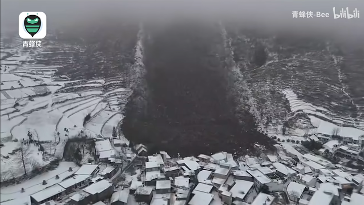
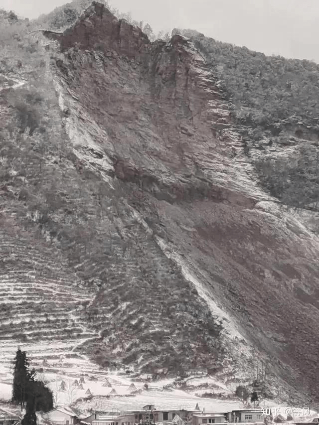

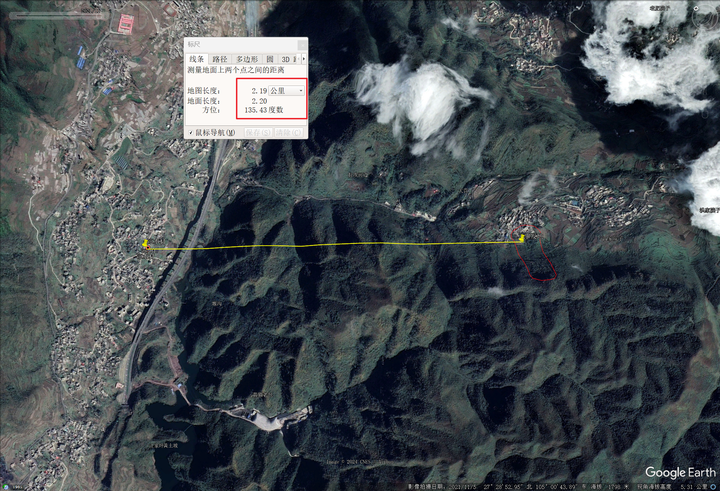
The failure location is not the Liangshui CBD. Satellite imagery does not show obvious mining scars.
Terrain at the back of the slide is extremely steep and loose, giving high instability risk.
Landslide Profile
By tracing the slide boundary from the video, I roughly drew the perimeter in QGIS.
When I first opened the satellite scene, the topography itself was striking.
The classic shape is like a chair with a backrest and armrest.
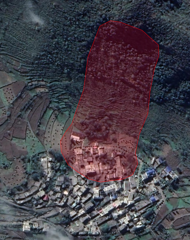
The burial zone was large; roughly one-quarter of the settlement appears covered.
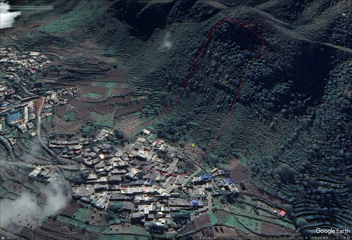
From the 3D view, the steep slope directly behind the village is very obvious.
Looking from space, this is a normal small village, and no mining pattern was obvious there.
Some online pages refer to mining near Gaopo Village, which is not this location.
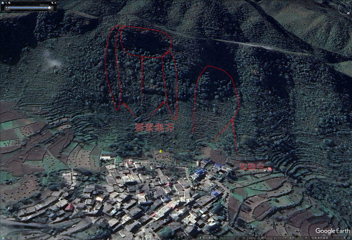
From satellite details, the rear scarp is steep with a large elevation drop, and clear tension cracks are visible along both lateral boundaries.
The image in 2021 already suggested this instability pattern before this year’s event.
It is hard to add much more.
Stay safe.
Updated: 2024-01-23
Coal Mining
Further checking confirms there is mining in this area, and the active zone is about 1.7 km from the failure area as the crow flies.
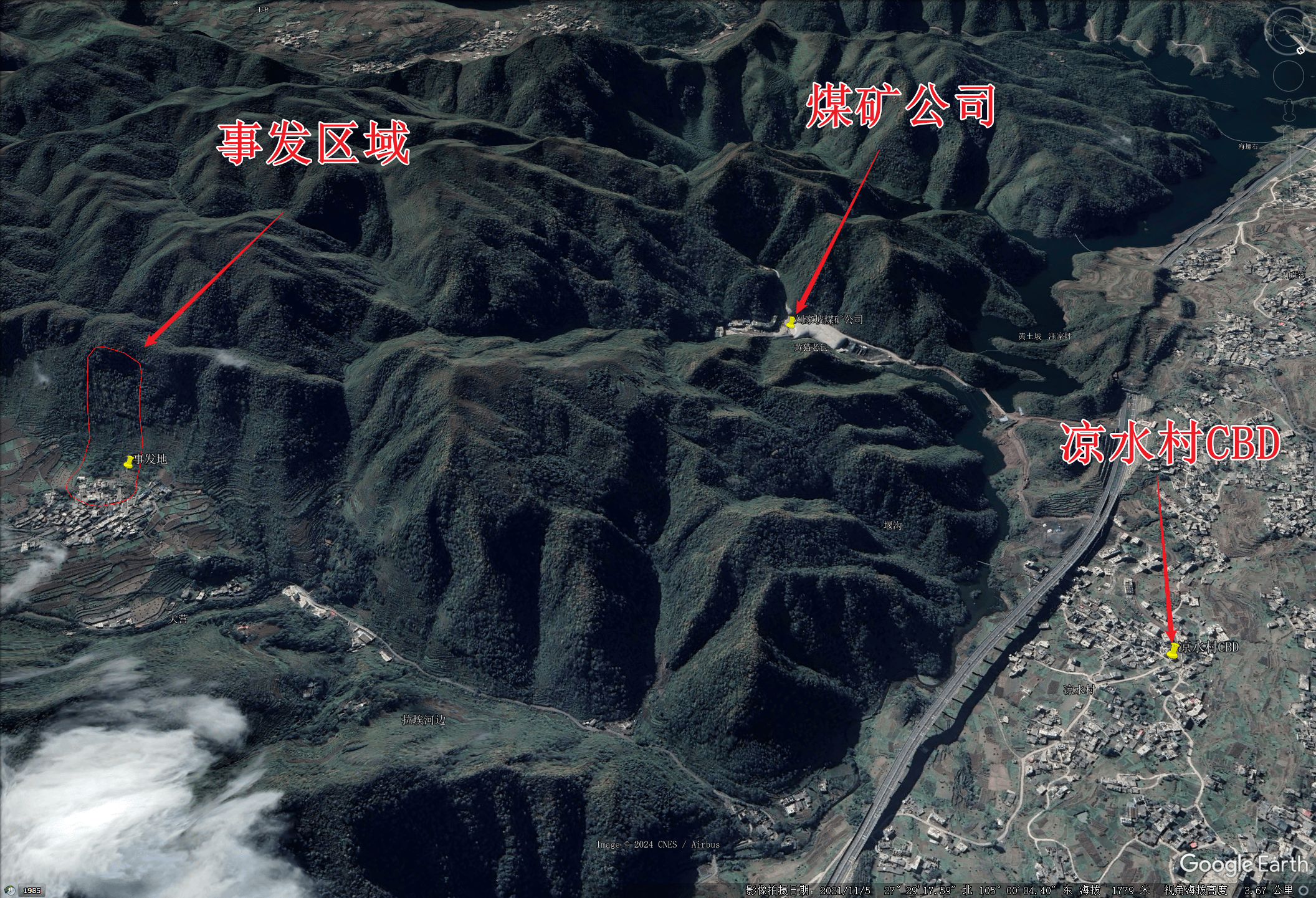
Mining may involve blasting and adjoined excavation, which could affect slope stability.
The mine entry appears separated from the failure area, so its influence might be limited.
(If I were in charge of mining planning, I would avoid cutting through the ridge in this section and choose other alignments.)
At present, mining seems more like an aggravating factor than the primary cause. I will wait for the official investigation.
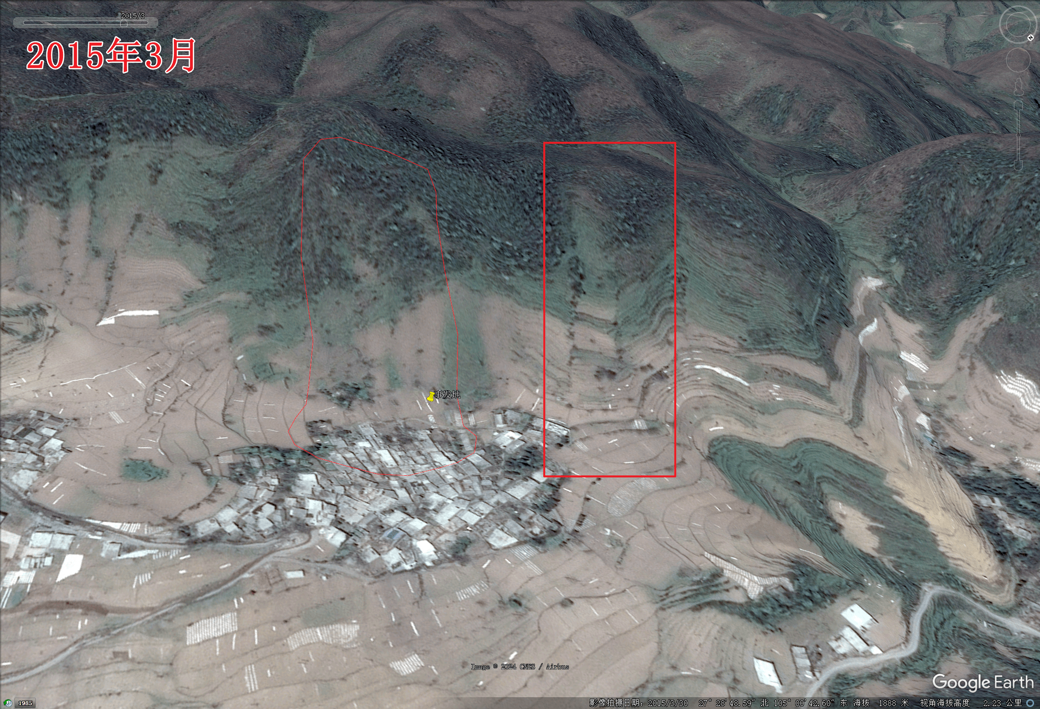
Historical Satellite Imagery
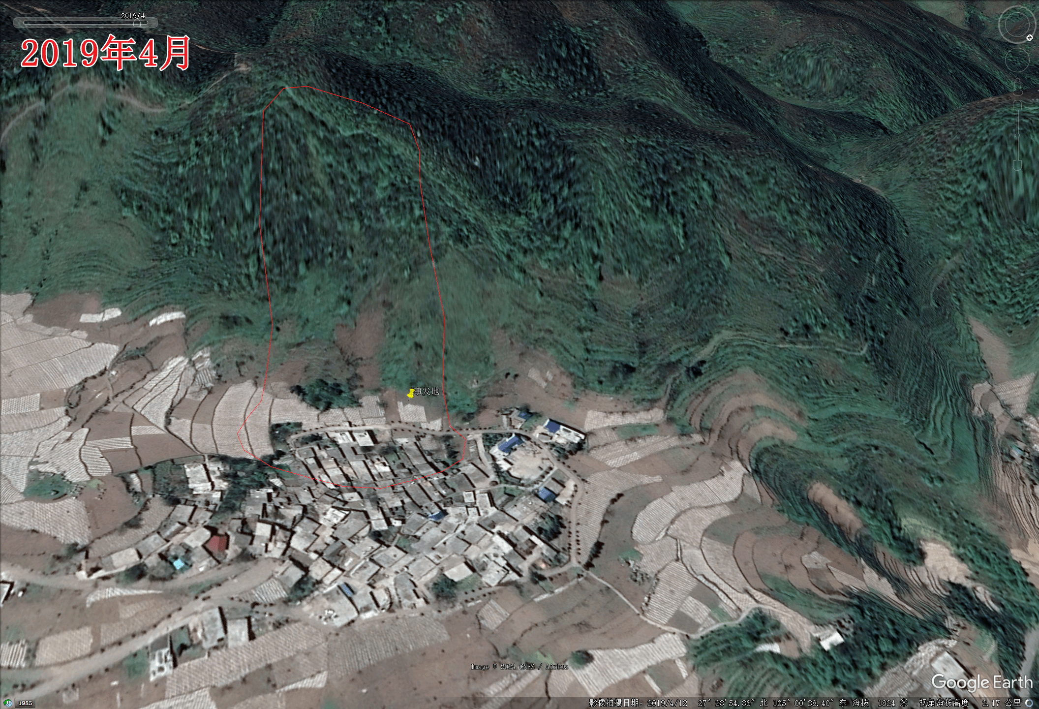
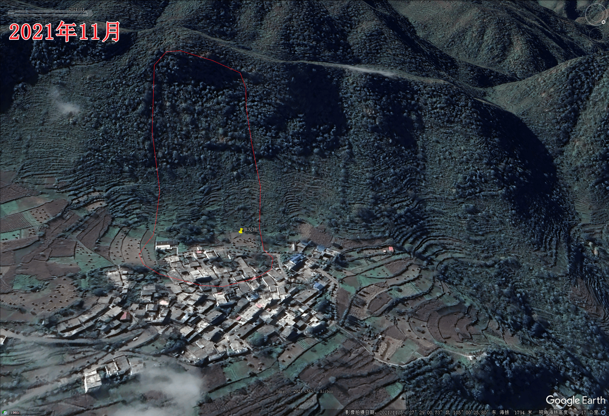
Updated: 2024-01-28
Professor Chen Ningsheng from CUG suggested that the landslide was likely triggered by a low-temperature frost-heaving induced instability of a critically stable slope body.
Updated: 2024-02-01
Yunnan Fire Department released an official special report showing on-site conditions.
References
 Wechat
 Alipay

![[徒步]宁波九龙爱心线](https://i.cuger.cn/b/d3c7f637-f0a4-4cfb-8e2b-23631aaba006.jpg)
![[出差]内蒙草原风光](https://i.cuger.cn/b/0039bc8f-15e8-4039-a286-9fb1d1af9e33.jpg)